At the end of May, the European Space Agency (ESA) launched its EarthCare satellite, which will investigate how clouds and aerosols affect our climate.
The Earth Cloud Aerosol and Radiation Explorer contains an atmospheric lidar instrument and multispectral imager, which will be used to study the complex interactions between clouds, aerosols and radiation within Earth’s atmosphere.
The satellite also contains a cloud profiling radar – the world’s first radar that can measure the velocity of upward and downward flow within clouds.
Understanding how aerosols will affect our future climate
Although it is known that clouds play an important role in atmospheric heating and cooling, they remain one of the biggest uncertainties in our understanding of how the atmosphere drives the climate system and, importantly, how they will shape the future climate.
Clouds reflect incoming solar energy back out to space, but they also trap outgoing infrared energy. This leads to either a net cooling or heating effect. However, the extent to which clouds warm or cool Earth depends on various factors including their shape, location, altitude, water content and particle size.
Aerosols are tiny particles such as dust and pollutants suspended in Earth's atmosphere. They also play a significant role in Earth's climate system, both ‘directly’ by reflecting and absorbing incoming solar radiation and trapping outgoing radiation, and ‘indirectly’ as they act as nuclei for cloud formation – which is how they influence our climate the most.
Human activities, including industrial processes, transportation and agriculture are significantly altering concentrations of aerosols in the atmosphere and thereby impacting regional climate patterns.
Atmospheric lidar measures cloud top height and aerosol physical properties
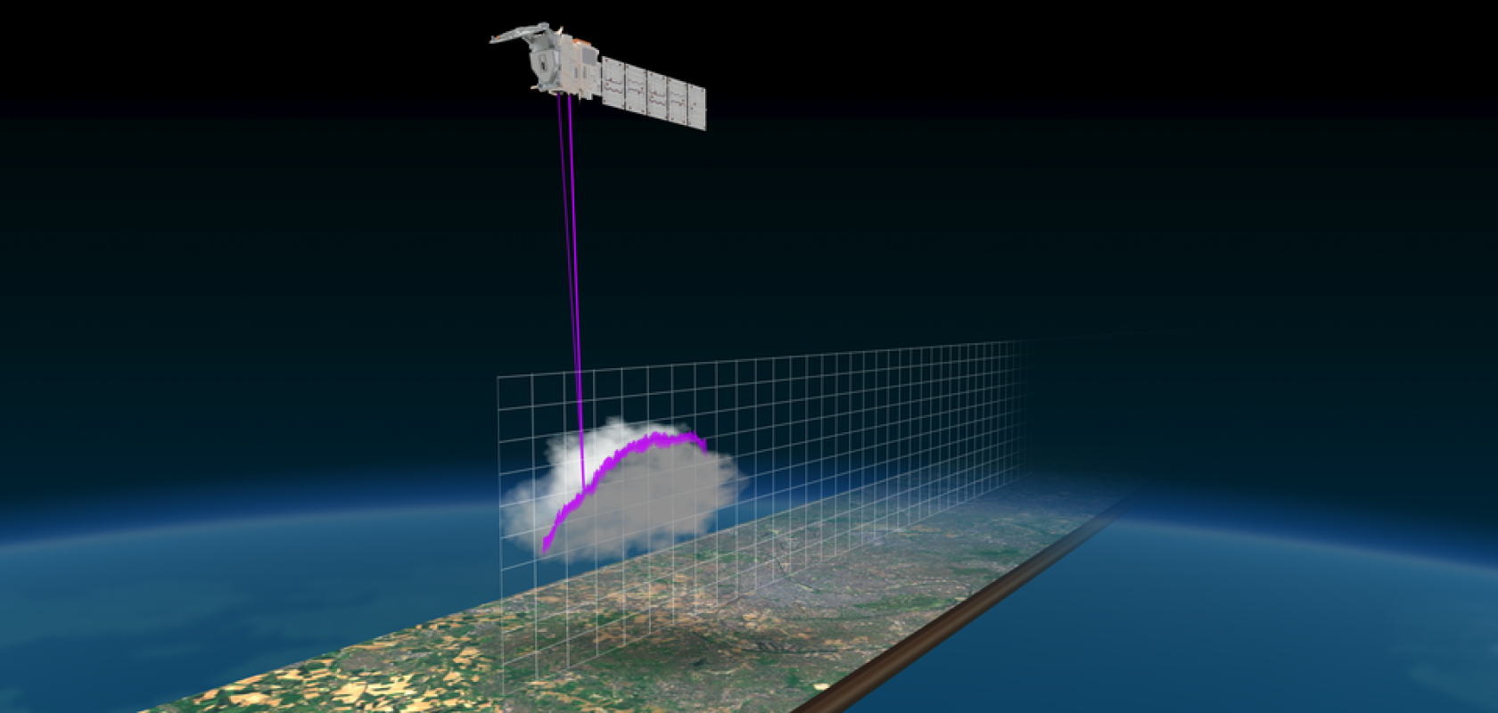
The atmospheric lidar collects profiles of optically thin clouds and aerosols. It is used together with data from the cloud profiling radar and the multispectral imager to derive cloud top height and aerosol physical properties, as well as classification of the various atmospheric components.
The instrument generates its own light source to scan the atmosphere, so it consumes a lot of power; almost 500W to generate the high-power laser beam.
The atmospheric lidar lies at the heart of the satellite, with a 62cm receiving telescope and twin emitter baffles underneath. The optical design is bistatic, meaning that it uses separate optics for the laser transmitter and for the receiver.
An ultraviolet laser beam is generated in the instrument transmitter. An intermediate reference signal, at 1,064nm, is generated using a laser in the reference laser head. This reference signal is used as the seed laser in the power laser head. Within the power laser head the seed signal is converted to 26 ns pulses with a repetition rate of 51Hz. The pulses are amplified, to reach an average pulse energy around 31-35mJ, and the frequency is tripled to transform it to the desired 355 nm ultraviolet output.
The beam is emitted through an emission beam expander to produce a footprint that is 15m on the ground and pointing 3 degrees backwards of satellite nadir, to minimise specular reflection from ice clouds. A beam steering mirror within the power laser head allows alignment of the return signal onto the receiver telescope. The output beam from the transmitter is linearly polarised.
Multispectral imager with visible, SWIR and thermal infrared channels
With development led by Surrey Satellite Technology Limited (UK), the multispectral imager collects images over a 150km swath, with 500m resolution. It has seven channels: visible, near-infrared, two shortwave infrared and three thermal-infrared.
The imager comprises two cameras that are both mounted on a common bench and use shared electronics and control units.
A thermal infrared camera uses a single, 2D micro-bolometer array detector to collect images in three channels as the satellite passes over Earth. Telescope optics project each channel of the Earth scene onto a separate line of the 2D array detector.
As the camera view is then swept over Earth’s surface in a forward motion, the detector is operated with a technique called time delay integration, where the signal from the ground is added over successive lines on the detector to increase the signal-to-noise ratio. For this camera, 19 ground lines are summed for each channel, which increases the signal-to-noise ratio by a factor of about 4.5 times.
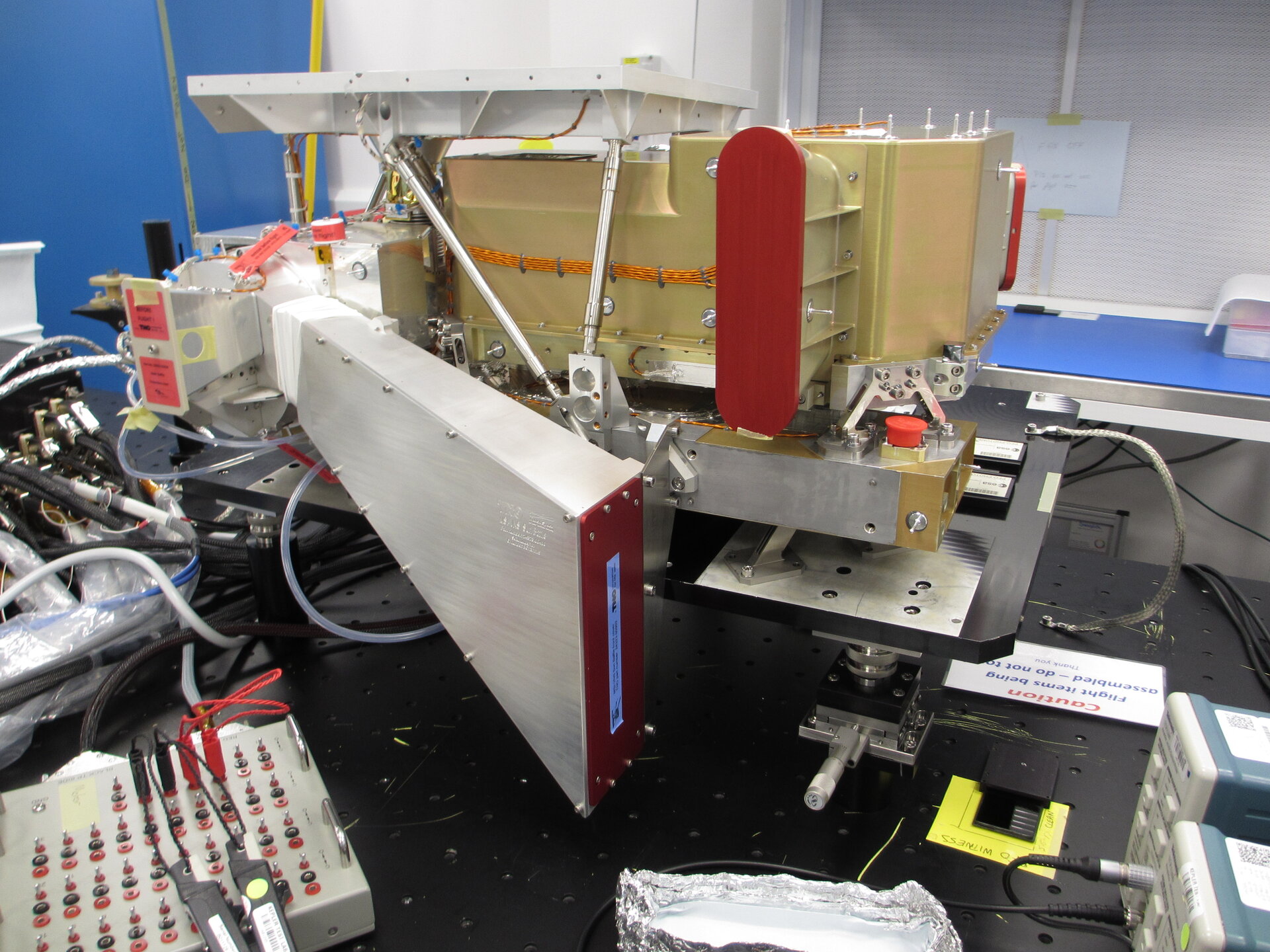
EarthCare multispectral imager optical bench (image: SSTL)
The visible, near infrared and shortwave infrared camera collects images in four channels in the wavelength spectrum from visible to shortwave infrared, apart from during night when it is not operated. There are two camera apertures, with one aperture dedicated to the second shortwave infrared channel.
Each channel has its own dedicated optics and a linear array photodiode detector. The second shortwave infrared channel detector is cooled with a dedicated radiator, to reduce detector noise. Successive image lines are collected on each detector as Earth passes underneath the satellite and the view of each channel is swept over the surface in a pushbroom motion.
“EarthCARE is the most complex of ESA’s research missions to date," said ESA’s Director of Earth Observation Programmes, Simonetta Cheli. "The mission comes at a critical time when advancing our scientific knowledge is more important than ever to understand and act on climate change, and we very much look forward to receiving its first data.”