A Swiss-Austrian consortium is set to test large-area laser scanning applications in the Swiss Alps, using innovative drones. Drone company Dufour Aerospace and laser scanner developer Riegl are partnering with data experts and an avalanche research facility for tests.
There is growing interest among various private and public stakeholders in high-resolution, up-to-date and cost-effective data, particularly in the area of alpine environmental hazards or energy production. The test series aims to demonstrate the efficiency of using drones for large-scale, high-resolution laser scanning, which is only possible on aeroplanes and helicopters today.
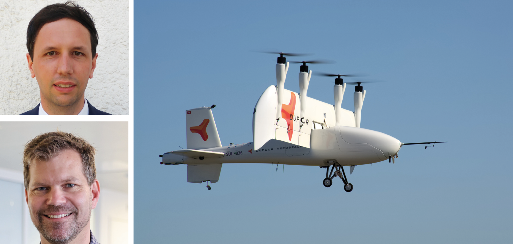
“We believe that, compared to small drone operations, the use of larger drones – which are able to carry heavier sensor equipment – can replace helicopters and aircraft in the medium term, and lead to better efficiency and more sustainability in aerial laser scanning activities,” said Sascha Hardegger, Dufour’s Chief Commercial Officer.
Dufour Aerospace’s three-metre-wingspan AeroMini and six-metre-wingspan Aero2 unmanned aerial systems (UASs) will be used in the project, along with Riegl’s laser scanners, which the company will help integrate onto the drones. BSF Swissphoto will contribute to data validation and assess the commercial relevance of the technology, while the WSL-Institute for Snow and Avalanche Research (SLF) will ensure that the data meets quality requirements, and serves applied science use cases. The proof-of-concept is divided into different steps. Riegl will first integrate its VUX-120-23 laser scanner into Dufour’s Aeromini, a vertical takeoff and landing (VTOL) drone with a maximum take-off weight (MTOW) of 25kg. “The goal is to accomplish VLOS and beyond the visual line of sight (BVLOS) flights and data acquisition campaigns with this setup first,” said Michael Mayer, Managing Director RiCopter UAV, part of Riegl.
Dufour’s Aero2 will then be equipped with a Riegl laser scanning system that has a higher-range performance, for example the Riegl VUX-240-24 or the Riegl VQ-580II-S.
Riegl’s technology focuses on pulsed time-of-flight laser radar technology at multiple wavelengths, and, while its scanners are technically capable of capturing data over larger areas at higher altitudes for uncrewed applications, the project provides the opportunity to prove this.
“While we already have a lot of experience with using our high-end sensors with unmanned aerial systems (UAS), this is nowadays mostly limited to smaller areas using multicopter types, single-rotor drones or VTOLs of smaller scale,” Mayer said.
Integrating optical sensors onto drones needs to be carefully planned and executed. Dufour’s tilt-wing drones, for example, rotate the aircraft’s wings horizontal wings during vertical takeoff and landing.
“Validation flights will show if there are remaining issues, such as vibrations or other potentially negative factors,” Hardegger said. “However, all the partners of our project have sufficient knowledge to overcome technical issues. While this project is aiming to demonstrate technical feasibility, another challenge will lie in the scale-up of such operations, also with a view to regulations.”
The team says it will be a key factor for the future use of uncrewed airborne solutions, along with the further development of the integration of UAS into the airspace in order to be able to carry out BVLOS flights.