Researchers from the University of Utah, United States, have developed a lidar mapping tool that could help firefighters make crucial safety decisions with an eagle's eye view.
The study, published in the International Journal of Wildland Fire at the end of September, is the first attempt to map escape routes for wildland fire fighters from an aerial perspective, the research team has said. Lidar technology was used to analyse the terrain slope, ground surface roughness and vegetation density of a fire-prone region in central Utah, and assessed how each landscape condition impeded a person's ability to travel.
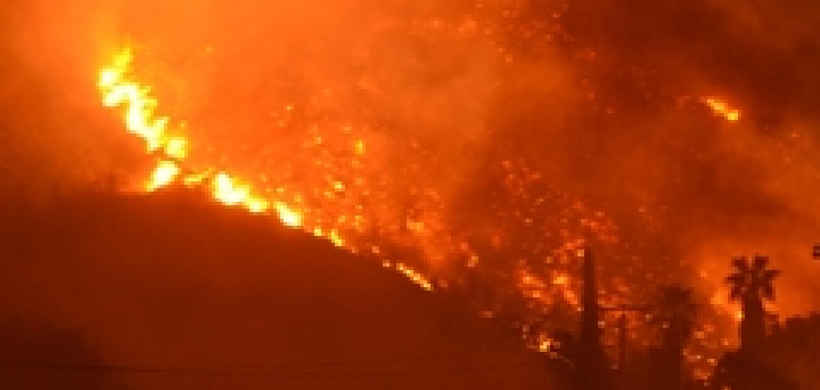
Every year, tens of thousands of firefighters risk their lives to save timber, forests and property from destruction. The ongoing wildfires in California, for example, have resulted in almost 200,000 residents being evacuated from their homes, three firefighters being injured and about 500 buildings destroyed. The Thomas fire in Ventura County to the north of Los Angeles remains the largest of the blazes and has spread as far as the Pacific coast, consuming 180m2 (466km2) since it broke out on Monday 4 December, according to figures quoted by the BBC.
Currently, firefighters base all of their decisions on ground-level information using fire safety protocols, such as the Incidence Response Pocket Guide. The guidelines recommend avoiding steep slopes, dense vegetation, and rough ground surfaces when designating an escape route.
'It's built into the safety protocol, but there are no numbers behind it. What is steep? Is it steep uphill? Downhill? What is dense vegetation?' said lead author Michael Campbell, doctoral candidate at the university's Department of Geography. 'Using lidar information, we were able to turn it from these subjective judgement calls into something more robust and quantitative.'
'Finding the fastest way to get to a safety zone can be made a lot more difficult by factors like steep terrain, dense brush, and poor visibility due to smoke. This new technology is one of the ways we can provide an extra margin of safety for firefighters,' added co-author, Philip Dennison, Department of Geography professor.
Mapping escape routes
Firefighters identify escape routes by assessing the landscape on the ground. The three conditions that determine how efficiently a firefighter can move through an area are terrain steepness, or slope, vegetation density, especially of plants in the understory and ground surface roughness, such as a boulder field or a well-maintained dirt road.
The study used a combination of lidar, geographic information systems, and human volunteers to examine how landscape conditions impact a person's ability to travel within Levan Wildland Management Area in the foothills of Utah's Wasatch Mountains.
The volunteers timed themselves walking along 22 paths that the researchers designed to capture a variety of slopes, ground surface roughness and vegetation densities. The researchers compared these travel times to lidar-derived estimates of the three landscape conditions along the transects, and extracted their effects on travel rates.
The analysis revealed that the fastest travel rates with respect to slope are slightly downhill, and going steeper uphill or downhill reduces travel speed on average. As vegetation density increases, travel rate decrease and as ground surface roughness increases, travel rates also decline.
'A lot of it is intuitive; if you're walking through dense vegetation, you're going to move more slowly than you would through a field of grass. But we found that no-one had quantified just how much vegetation density or surface roughness can slow you down,' said Campbell.
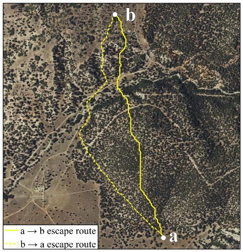
Campbell ran thousands of simulations evaluating potential escape routes within the study area by choosing random starting points representing a crew location, and random end points representing a safety zone. Credit: Campbell, et al. 2017, CSIRO Publishing
After assessing travel impedance, Campbell ran thousands of simulations evaluating potential escape routes within the study area. He chose random starting points representing a crew location, and random end points representing a safety zone. By plugging the effect of slope, ground surface roughness and vegetation density on travel rates into a route-finding algorithm, he successfully identified the most efficient routes.
Quantifying landscapes from the sky
According to Campbell, although the current method of using expert knowledge of fire behaviour to assess how best to tackle it works up to a point, quantifying this behaviour would provide firefighters additional, reliable information to deal with wildfires.
Lidar's ability to map both understory vegetation and ground surface roughness at very high levels of precision, means it is sensitive enough to pick out individual bumps, rocks and boulders on the ground surface with a resolution of 10cm per pixel. Therefore, by using lidar information, the researchers were able to turn subjective judgement calls into something more robust and quantitative.
The result of a lidar data collection effort is a 3D 'point-cloud' containing millions of points that record the longitude, latitude and elevation of the structural features that make up a given landscape. When combined with the lidar-derived landscape conditions, firefighters can apply existing route-finding algorithms to the data to identify the path of least resistance.
Bringing the technology into a wildfire
Lidar data currently aren't well-suited to real time mapping of evacuation routes, because they can take a long time to process and coverage is limited in some regions. However, land managers in areas with high wildfire risk could prepare the data ahead of the fire. With the lidar information in hand, firefighters could run the route-finding software to identify escape routes in real-time.
'The goal is to turn this into a tool that can be implemented in a realistic sense,' said Campbell. 'Because our work is sponsored by the US Forest Service, we hope to get our tools into the hands of people on the ground, and turn it into something that's used in a fire-fighting scenario.'
Bret W Butler of the USDA Forest Service Rocky Mountain Research Station in Missoula, Montana also contributed to this work.
