What caused the 'mystery' green laser wall in Hawaii?

Share this on social media:

A line of green laser pulses captured by an observatory camera over Mauna Kea, Hawaii, have been met with alarm in some circles online

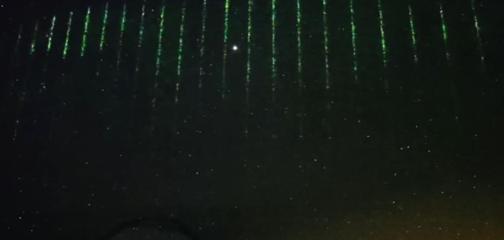
A wall of ‘mystery’ green laser pulses captured by a camera at the Mauna Kea Observatories in Hawaii has been making headlines worldwide amid rising tensions around flying objects over Canada/US and so-called ‘spy balloons’ allegedly launched by China.

The video and images of the vertical laser lines were released on the website of the Subaru Telescope, operated by the National Astronomical Observatory of Japan (NAOJ).

NAOJ and the Asahi Shimbun newspaper company had installed an ultra-high sensitivity camera on the telescope to livestream views from the clear skies over the dormant volcano.

Viewers of the livestream spotted the pulsing green lights moving across the landscape after midnight on the morning of 28 January, according to the site.

The laser pulses were initially thought to be a remote-sensing laser that formed part of the Advanced Topographic Laser Altimeter System (Atlas) aboard NASA’s ICESat-2 satellite.

Electro Optics has written about the NASA satellite before, covering the optics in the ice-sensing satellite as far back as 2010.

IceSat-2 again featured in the March issue of Electro Optics – ‘Lasers and sensors offer bird’s eye view on climate change’. 

However, the NAOJ’s website states that “Anthony J. Martino, a NASA scientist at the ICESat-2 team, and his colleagues led by Alvaro Ivanoff found that the laser lights were most likely from Daqi-1, a Chinese atmospheric environment monitoring satellite”. 

While the news that a Chinese satellite may be firing laser beams onto a US state was met with alarm in some circles, western nations and space agencies also have many remote sensing satellites in orbit tracking concentrations of pollutants, such as nitrogen dioxide (NO2), ozone (O3) and particulates in the atmosphere.

Developed by the Shanghai Academy of Spaceflight Technology (SAST) and launched in April 2022, Daqi-1 is the world’s first satellite capable of detecting CO2 using lidar, according to SAST. Designed to work in a sun-synchronous orbit of 705km, SAST says the 2.6-tonne vehicle has five remote sensing instruments – atmospheric sounding lidar, high-precision polarisation scanner, multi-angle polarisation imager, ultraviolet hyperspectral atmospheric composition detector and a wide-range imaging spectrometer. 

It is the Aerosol and Carbon Detection Lidar (ACDL) aboard the satellite that is thought to have caused the green lasers visible over Hawaii. This operates in a similar way to the three-laser integrated path differential absorption (IPDA) system tested by NASA to monitor greenhouse gases several years ago.

Visit the Subaru telescope homepage.

Quantum computer innovation has been chasing faster gate speeds for the past two decades (Image: Shutterstock/Quardia)

11 October 2022

An example of an atomic-photonic integrated chip for cold atoms (Image: Andrei Isichenko)

20 March 2023

The technology shows promise for use in flexible devices across applications in medicine, optical communications, machine vision, and surveillance (Image: TU/e | Bart van Overbeeke)

21 February 2023

OroraTech’s Forest-1 nanosatellite carries a thermal infrared detector to detect wildfires in low Earth orbit. Image: OroraTech

13 February 2023