Matthew Dale takes a look at some of the space technologies presented at Laser World of Photonics, including lidar for global methane analysis and laser communication technology
The potential of using lasers to transmit data between satellites in space or to and from Earth was discussed during the ‘Space meets laser world of photonics’ forum, which took place on 27 June at Laser World of Photonics. Such technology promises long-distance communication that is significantly faster and more secure than existing techniques.
Dr Manfred Leipold, head of procurement management at laser communications firm Vialight, discussed how the company is looking to establish 10Gbps data connections between multiple satellites and earth using eye-safe lasers for optical communication.
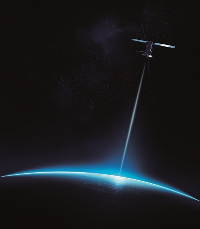
ViaLight’s communication systems comprise a low-power laser system beaming information to an optical receiver between satellites, enabling connection speeds 40,000 times faster than those currently used. The systems are designed to meet the restrictive low size, weight, and power consumption (SWaP) constraints of space scenarios, and operate at 1,550nm using minimal power density eye-safe laser beams.
Laser communication works by using an accurately steered infrared laser beam to transmit data unguided through space, enabling data speeds orders of magnitude faster than competing long-distance communication technologies. In addition, laser communication can be used without restrictions, avoids interference issues by nature and is 100 per cent secure – it cannot be tapped, jammed or spoofed. It also offers the physically lowest possible latencies that are up to 30 per cent shorter than for optical fibres.
ViaLight is currently looking at systems for low orbit usage, which once established, will be able to operate over a distance of 4,000km. One potential applications for these systems could be on Earth observation satellites, allowing them to beam data in real time down to the planet’s surface.
‘A concept of one of our customers was a new space low earth orbit constellation of active satellites moving in separate orbital planes,’ said Leipold at the photonics forum. ‘The satellites will communicate with each other at 10Gbps. Once the range is beyond 4,000km they switch to the next approaching satellite. We are adapting and tailoring to the European Standardisation System ESS standards as we define this approach.’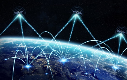
ViaLight’s communication systems comprise a low-power laser system beaming information to an optical receiver between satellites. (Credit: Shutterstock user sdecoret)
The concept of this constellation will accommodate four laser terminals per platform, each acting as an independent autonomous package offering a cross pointing assembly that can locate and track adjacent satellites.
In parallel, ViaLight is working on a space-ground optical link hardware, such as those that could enable real time data delivery from global monitoring satellites. The company is also looking at developing a network of ground stations linked by their lasers, and ground-air systems that could beam high-speed wi-fi onto jets travelling at supersonic speeds. The maximum achievable distances between these systems will depend on atmospheric conditions – in the stratosphere ViaLight’s systems work to a range of 600km.
The space data highway
Also at the forum, Delphine Mery, market development manager at the Airbus Group’s SpaceDataHighway firm, explained how low-orbit observation satellites often have to travel to the other side of the planet before they can deliver their data to the surface. SpaceDataHighway has therefore implemented a data relay infrastructure that uses lasers on geostationary satellites to transmit information between low Earth orbit satellites, spacecraft or ground stations at the speed of light. Rather than waiting hours before flying over a fixed ground station, satellites can deliver their data instantly.
‘Why did we choose to implement this solution? Mainly for the latency purposes, as now, instead of waiting hours to obtain imagery, it can be obtained instantly,’ remarked Mery. ‘Optical communications are also very difficult to detect and intercept, really the worst that can be done is the removal of the link, and not actually the capturing and reading of the data.’
The company’s first satellite, Icarus, was launched in January 2016 and has been fully operational since last November. ‘Now we are serving three satellites daily, and we will serve four by the end of the year,’ commented Mery ‘We have performed 2,000 successful links with the system and have realised that the quality of the data has exceeded our original expectations.’
Although SpaceDataHighway is not the first to use satellites to relay information, it is the first to couple the technology with a laser. So far, the company has enabled the European Commission to download 50 per cent more data than it ever could have using standard ground station networks.
‘We are currently working on research satellites that will be placed over the Asia Pacific region,’ said Mery. ‘Up until recently we have been very European focused, however now we are developing with 11 countries and several international organisations.’
With its future international partnerships, SpaceDataHighway won’t necessarily be using the same technology as that aboard Icarus. ‘We want to implement new innovations, such as being able to transfer data from one geostationary satellite to the other side of the world, enabling data to be transferred from the Asia-Pacific to Europe at the speed of light,’ Mery explained. She also expressed that one day optical communication could be used to communicate with places such as the Moon, or Mars.
‘This is just the beginning of a very exciting story,’ she concluded.
Lidar for global methane analysis
In 2021, a mini-satellite will be launched as part of a collaborative mission to study atmospheric methane, which is reportedly 25 times more potent in causing global warming than carbon dioxide.
The Franco-German Methane Remote Sensing Lidar Mission (MERLIN) intends to monitor and map methane emissions on a global scale with unprecedented accuracy, using a lidar system designed by the Fraunhofer Institute of Technology. The instrument was presented by Fraunhofer at Laser World of Photonics.
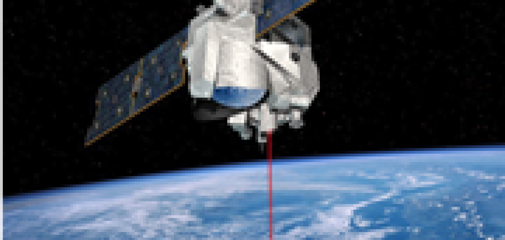
Merlin will use its on-board lidar system to analyse methane emissions in the earth's atmosphere. (Credit: Shutterstock user Johan Swanepoel)
Merlin was formed in 2010 in a bid to better understand how methane is introduced into the atmosphere and where it is degraded. The lidar system sends light pulses into the atmosphere and determines the concentration of methane from the backscattered light. The advantage of lidar is that, unlike optical spectrometers, it doesn’t require solar radiation; therefore, measurements can still be obtained in the absence of light - the dark side of the Earth, for example.
The lidar system aboard Merlin consists of an oscillator with active length control, an InnoSlab amplifier with a wavelength of 1,064nm and an optical parametric oscillator (OPO) with two potassium titanyl phosphate crystals. For methane emission monitoring, the laser must provide 9mJ double pulses at two wavelengths around 1,645nm in single-frequency operation, with one of the pulses always precisely adjusted to a characteristic methane absorption line. The lidar system is due to go into operation in about three years, with the production technologies and the test procedures having already been established.
The preliminary design review status for Merlin was achieved last year, with the critical design status and construction of an engineering qualification model now underway. This model will later be subjected to extensive tests in order to prove its suitability for use in space.
The Merlin project has been funded by the German Ministry for Economic Affairs and Energy and is coordinated by DLR.