The Norwegian Public Roads Administration (NPRA) is collaborating with three Scandinavian research groups to explore how lidar technology could be used to measure the wind conditions across the world’s longest proposed floating bridge. According to the researchers, the technique could provide new data on how bridges should be designed in a more optimal way to match wind conditions.
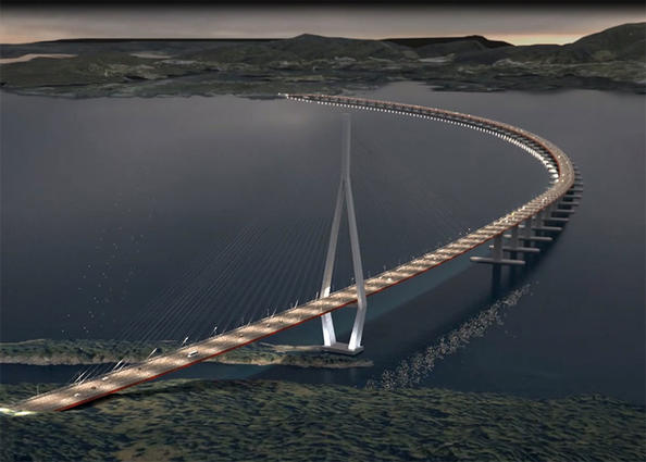
An artist's impression of the proposed 5,000m floating bridge, which will be designed using data from lidar wind measurements. (Credit: SVV/ViaNova/Baezeni)
Once completed, the 5,000-metre-long bridge will cross the Bjørnafjord, a fjord located south of Bergen, and will be supported by floating pontoons.
Researchers from the Norwegian University of Science and Technology (NTNU), the University of Stavanger (UiS) and Chalmers University of Technology will work with the NPRA to establish a lidar wind measurement system across the bridge. Lidar involves emitting invisible light pulses into the air and measuring the backscattered signals from particles that move with the wind. The difference between the frequencies of the emitted and the received pulses reflects the wind velocity in the direction of the light pulse.
According to UiS Professor Jasna Bogunovic Jakobsen, until now, only limited knowledge has been acquired about the wind conditions around fjord bridges. With lidar, however, it is possible to monitor wind conditions at a number of locations across the entire structure. ‘The new method gives us more detailed knowledge about the conditions in the middle of the fjord, where the steady wind and the wind gusts typically have the strongest impact on the bridge,’ she said. ‘By using this measurement method we reduce uncertainty when estimating the wind loads and the wind effects on a bridge.’
While the new measurement method is costly, it provides new and important data that enables bridges to be designed in a more optimal way to match wind conditions, according to Jakobsen.
Jakobsen and her team began the six-week project for the proposed bridge accross the Bjørnafjord in Spring 2016. Three lidar devices were placed on shore with their light beams directed towards the water, with the aim of getting detailed and accurate information on the spatial and temporal variation of the wind.
‘A very long floating bridge is very sensitive to wind- and wave excitation,’ commented Jakobsen. ‘It is therefore important to connect the long-term, “point” wind measurements by anemometers on the met-masts on land to the actual wind conditions above the water, to ensure that we get the best possible estimate of how much the bridge will move and all the stresses wind creates in the structure.’
A calculation model for bridge vibrations due to wind must be calculated by comparing recorded vibrations to estimated vibrations based on the wind load characteristics measured with small-scale models in wind tunnels. The aim is to develop accurate calculation models for bridge vibrations due to gusty winds.
Mathias Egeland Eidem, project manager for the proposed bridge from the NPRA, must balance the design criteria of the bridge between cost and structural integrity. The bridge is one of seven proposed crossings in the NPRA project ‘Ferjefri E39’, which, in addition to crossing Bjørnafjord, will also span Halsafjord and Sulafjord.
Commenting on the proposed longest floating bridge, Eidem emphasised the need for lidar technology: ‘It is the first time we [will] develop a bridge of these dimensions. Gathering as accurate information as possible about waves, currents and wind conditions is therefore crucial.’
‘When we have obtained sufficient data and developed an optimal calculation model, we will be able to set the correct design criterion for the bridge we are about to construct,’ Eidem concluded. ‘Much of the work will then be behind us.’
Since 2014, the NPRA has been working with UiS researchers to monitor bridge wind conditions using lidar, which included a study of a 640-metre-long suspension bridge. By placing a long-range lidar sensor at a nearby on-shore location, they were able to scan the wind around the bridge at a distance of almost two kilometres. ‘It was encouraging to see that the wind velocities recorded from such a large distance matched well the data from the anemometers on the bridge’, commented Jakobsen, who led the lidar wind measurement project. Two fast-scanning, short-range lidar systems were also used later that year, which revealed how the wind passes around the girders of the bridge. The data was visualised as a detailed colour wind profile by the researchers.
Construction of the longest floating Bjørnafjord bridge is anticipated to begin in 2023.