Airborne light detection and ranging (lidar) technology has become a valuable technique for various applications, such as oil and gas exploration, urban planning, and air pollution monitoring. It has even assisted in the recent discovery of ancient cities near the Angkor Wat temple complex in Cambodia.
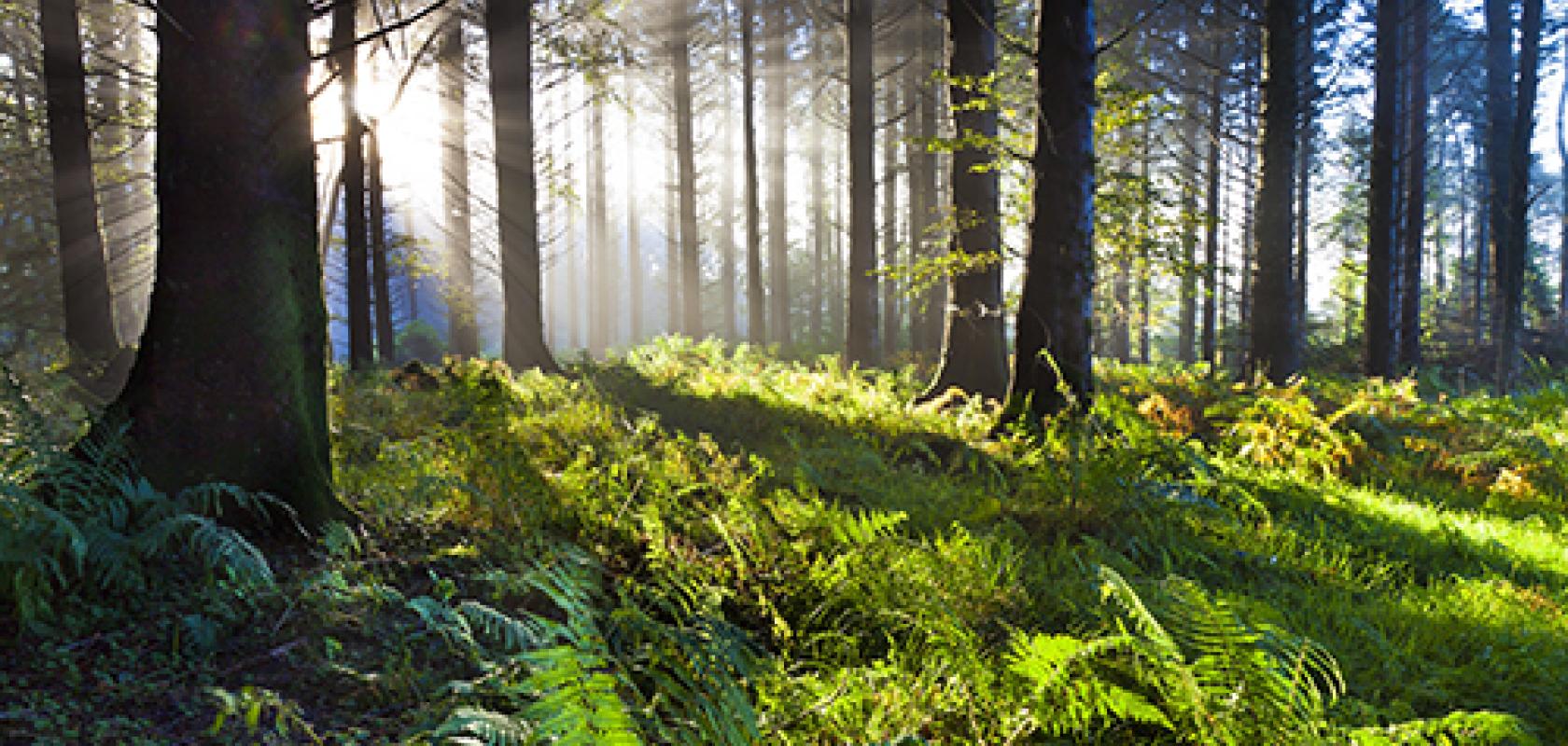
But its role in forest mapping could play a part in protecting one of the world’s most threatened ecosystems, its rainforests. Because of a unique ability to penetrate dense forest canopies, lidar provides researchers with a tool to visualise the structure of trees and determine how much carbon they store. The technology has allowed conservationists to expand their studies and cover much larger areas than before with a greater degree of accuracy.
Lidar studies in central and western Africa, home to the largest rainforests outside of the Amazon, are helping scientists better understand how to conserve tropical forests in the Democratic Republic of Congo in a bid to regulate carbon emissions, and also help the government in Gabon plan palm oil agriculture in a way that causes the least environmental impact.
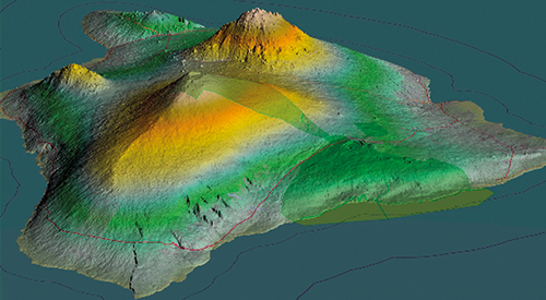
A country-wide carbon map
Lidar has been instrumental in helping create the most detailed map to date of forests in the Democratic Republic of Congo, home to 60 per cent of Africa’s rainforests.
The map1, published at the end of May by UCLA’s Institute of the Environment and Sustainability, the World Wide Fund for Nature (WWF), and the Congolese government, shows the amount of carbon stored in tropical forests across the entire country, which will help in global efforts to protect them.
The $8 million study, which was funded by the German Federal Ministry for the Environment, Nature Conservation, Building and Nuclear Safety, combined data collected by satellites and lidar-equipped aircrafts, to map the height and crown of trees at a fine-scale resolution. This data helped determine how carbon distribution correlates with topography, soil type and rainfall.
‘It gives us a picture of how the land looks, the structure of the landscape, vegetation types and how it all changes over time,’ said Professor Sassan Saatchi, an expert on tropical forests and the global carbon cycle with UCLA and NASA’s Jet Propulsion Laboratory.
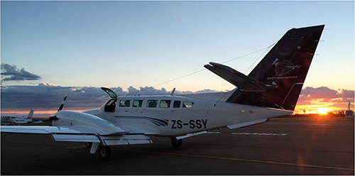
A lidar-equipped aircraft used by the Southern Mapping Company
Accurately measuring the rainforest is an important part of a conservation strategy known as the Kyoto Protocol, which was introduced in 1997. The method, Reducing Emissions from Deforestation and Forest Degradation in Developing Countries – or REDD+, for short – places a cash value on the carbon that is contained and kept from being released in each hectare (10,000m2) of forest. The price can range from $20 to $50 per hectare, Saatchi said.
Pricing carbon enables organisations like the World Bank, USAID and the German KFW Development Bank to offer a financial incentive to conserve rainforests in densely-forested countries like the Congo.
‘Future carbon markets will essentially finance conservation,’ said Aurélie Shapiro, a remote sensing specialist with WWF Germany. ‘A country that might pollute a lot could actually offset their emissions by conserving forests in the DRC. It’s like a global market – we’re trying to reduce emissions overall, but the more we can conserve in a place like the Congo the more we can regulate emissions elsewhere.’
Southern Mapping Company was contracted to handle the airplane-based data collection. Using single- and twin-engine aircraft, the firm covered approximately 6,000km2 of the Congo basin, collecting 20 billion points of lidar data and taking more than 43,000 photographs.
An Orion M300 lidar system, supplied by Teledyne Optech of Canada, was deployed for the project. To calculate tree heights, in simple terms, the system emits 300,000 1,064nm laser pulses into the forest every second, and travel-time measurements for light reflected back provide the distances that make up a resulting high-resolution topography.
A mirror inside the lidar system oscillates the laser beam from left to right, which creates a zig-zag pattern along the flight path as the aircraft flies forwards.
A feature that allows for detailed structural information of the trees is that for each pulse, the lidar system is able to record four different elevation points, explained Norman Banks, Southern Mapping Company’s CEO: ‘When the laser pulse goes out it is a smooth pulse, but when it comes back you get several different returns. The first thing the laser pulse strikes is obviously the one that comes back the quickest, but then part of the laser energy continues and hits something else, it comes back and a little bit of the laser energy carries on further and it hits something else and so on,’ said Banks.
‘[Having four returns per pulse] is very useful for a tropical forest environment because you’re picking up the top of the canopy, you’re picking up two strikes somewhere in the canopy, and then you’re hopefully picking up the ground… So you’re able to get a very high quality ground model, even underneath a tropical forest canopy.’
Approximately 650,000 hectares of rainforest was scanned in fine detail for the project. Professor Saatchi extrapolated the data and calibrated it with field information from forest inventory plots established by WWF and local organisations to map 150 million hectares of Congolese jungle.
While the sample represents a small percentage of the whole, it is significantly larger than what is usually collected. Traditional methods of assessing carbon density rely on measuring tree diameter and identifying species by hand, which proves difficult in places like the Congo that lacks the necessary infrastructure and workforce. From air and space, a much larger area was sampled, with measurements made of tree height and crown size. This enabled researchers to calculate the mass of the forest, which directly correlates to how much carbon it holds.
Future lidar
According to Banks, whose company offers a range of remote sensing technologies for aerial surveys, lidar technology has significantly improved over the last two decades, permitting much more detailed conservation studies. For instance, the first system the company purchased in 1997, which was deemed ‘state of the art’, emitted 5,000 pulses per second and recorded one return per pulse.
Banks sees that in the coming years, lidar will be combined with other remote sensing technologies, such as multispectral imaging, so that spectral information can be obtained in addition to elevation.
‘So, you can have a single pixel that has 300 to 400 different spectral values, in addition to several elevation values, which will allow people to do significantly different analyses on vegetation, disease, species, stress, pollution and so on,’ he said. ‘For me, fusing information from two or more different techniques is where the industry is headed.’
This would be done by using multiple separate systems co-mounted onto an aircraft, or flying over the same area twice, Banks said.
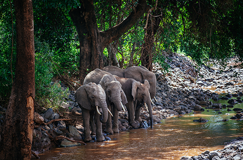
Lidar could help researchers understand the way elephants move through forests
Technically, this wouldn’t be much of a challenge, he added, but at the moment multispectral technology is too expensive to be a standard technology for this type of application.
‘Hyperspectral is a technology whose time is still coming; it is not yet mainstream. One definitely has an issue that you can get cheap and cheerful, or expensive and good; the sweet spot is not quite there yet. We certainly offer multispectral as a technology, but we are finding that, at the moment, people tend to find the price to be a bit too high at the moment.’
From his experience, at the moment, lidar is more accepted and has become the default technology for elevation mapping.
Reducing palm oil’s carbon footprint
A separate group research group from Duke University in North Carolina is using lidar data as part of an initiative to limit the environmental impact of palm oil agriculture in Gabon, a neighbour to the Democratic Republic of Congo.
For the last several decades, palm oil production has been based mainly in Southeast Asia; however, the industry is now growing rapidly in other tropical zones, including Central and Western Africa and the Neotropics.
While palm oil allows for an emerging developing country like Gabon to diversify its economy, its cultivation has become controversial, because ecologically diverse areas of rainforest are often cut down and replaced with a monoculture. This results in various environmental and social effects such as habitat loss, soil erosion, air pollution and soil and water polution.
According Dr John Poulsen, assistant professor of tropical ecology at Duke University’s Nicholas School of the Environment, the Gabonese government has been trying to increase agriculture production in the country for two main reasons: firstly, so that its economy is less reliant on oil stocks that are now dwindling; and secondly, in a bid to produce more of its own food, which at the moment is mostly imported from Cameroon or other foreign countries.
But in a country that has around 88 per cent forest cover, to expand agriculture means deforestation. ‘Until recently… the rate of deforestation has been close to zero,’ said Poulsen.
‘The government understands the need to deforest, but at the same time the President has made pledges to mitigate global climate change and protect biodiversity,’ Poulsen noted. ‘So, they are caught in a balancing act between needing to develop the economy and conserve the environment.’
To help the Gabonese government achieve a suitable balance, Poulsen and his team are conducting research that will assist future agriculture planning in a way that mitigates the impact on climate change and biodiversity.
Using a combination of field data and lidar, they were able to calculate the amount of carbon in the country’s palm oil concessions, and then predict the level of emissions under different scenarios of deforestation for agriculture.
‘This allowed us to make recommendations [to the Gabonese government] of where oil palm agriculture should be permitted, and led us to propose that agriculture only occur in forests with less than 108 to 118 megagrams of carbon per hectare,’ Poulsen explained. ‘So, a company could only cut down forest in areas where we know beforehand that the biomass is, for example, below 118 tonnes of carbon. Basically this allows conversion of small, mostly secondary forest and conserves large, mature carbon dense forests.
‘These recommendations help the government reach that sweet spot, where agricultural production is beneficial to the economy, but has the smallest possible negative effect on the environment,’ Poulsen added.
To predict how varying levels of deforestation could impact carbon emissions, Poulsen and his team used aerial lidar data that was obtained with a lidar-equipped small airplane that flew over Gabon’s palm oil concessions.
The lidar measurements allowed the researchers to produce a map of tree heights, which complemented field measurements of above-ground biomass for multiple forest plots. The team then used regression models to convert tree height measurements to above-ground biomass, and then calculate the amount of forest carbon.
‘We evaluated the level of emissions that would occur under different scenarios, such as the amount of emissions from converting the entire area to agriculture, or converting only areas with low forest carbon, or by setting aside offsets – areas of high conservation value forest,’ explained Poulsen.
Remote sensing technologies such as lidar are critical for these types of large-scale conservation studies, according to Poulsen. He explained that it still would have been possible to estimate forest carbon without lidar, but the team would have had to rely entirely on field measurements and extrapolating data from a few forest plots to give values for the entire forest.
‘The carbon calculations would have been much coarser, and we would have ended up with an estimate that was less precise and accurate,’ he said. ‘The enormous benefit of lidar is the ability to scale up the research and spatially map forest carbon with great precision over large areas. Instead of just knowing the density of carbon of a few hectares, by flying over oil palm concessions, we can map forest carbon over hundreds or hectares of land.’
Although lidar has been massively beneficial to this study, one limitation the researchers have experienced is the cost of the technology.
‘If the price of high quality lidar came down, we could do a lot more work at larger scales,’ said Poulsen. ‘We’ve been restricted in the science we want to do because we’ve been limited by cost.’
Poulsen pointed to a proposal to carry out a lidar survey across the whole of Gabon, which was cancelled because of cost issues. This kind of national survey would allow scientists to calculate forest carbon density as well as other environmental metrics for the entire country, which would help advance the land-use planning process and management of carbon emissions.
Another conservation effort that could benefit from lidar, if the technology lowers in cost, is the protection of elephants. Duke University scientists have been using remote sensing techniques in Gabon to help determine how elephants move through forests, in a bid to conserve their habitat and protect them from poaching. The group’s most recent research suggests that more than 25,000 elephants in Gabon’s Minkébé National Park may have been killed for their ivory between 2004 and 2014.
Currently, the team isn’t using lidar because, for the data they require, a higher-end system would be needed, which would be too expensive to be used for their research.
‘If we had fine scale maps of vegetation over large areas, like those that can be produced from lidar, it would help considerably with elephant conservation,’ Poulsen said.
In coming years, Gabon is poised for significant development, so land-use planning enabled by these types of studies will be crucial to ensure that different types of agriculture and other development activities, such as mining, logging, and infrastructure development have the least environmental impact as possible.
‘The Government knows that development will come rapidly in the next couple of decades, thus they are trying to get ahead of the curve – that’s exactly what needs to be done to ensure that development occurs in a sustainable way,’ Poulsen concluded.
References
1 www.wwf.de/fileadmin/fm-wwf/Publikationen-PDF/Carbon-Map-of-DRC.pdf
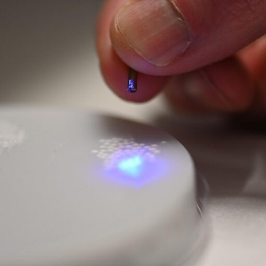
With a specially designed laser system and a new methodology based on gated digital holography, researchers from the Naval Research Laboratory have developed a method to give lidar systems an enhanced ability to see through otherwise obscuring elements of terrain like foliage or netting.
Paul Lebow, from the Naval Research Laboratory in Washington, D.C., presented the work at The Optical Society’s Imaging and Applied Optics Congress, which took place on 26 -29 June in San Francisco, California.
In the new methodology, the researchers use process known as optical phase conjugation to project a laser beam through the openings of the leaves, which allows users to see through a partial obscuration.
‘It was something that until maybe the last five years was not viable just because the technology wasn’t really there,’ said Lebow. ‘The stuff we had done about 20 years ago involved using a nonlinear optical material and was a difficult process. Now everything can be done using digital holography and computer generated holograms, which is what we do.’
The system uses a newly-designed laser that took a year and a half to develop. ‘The real key to making our system work is the interference between two laser beams on the sensor. We send one laser beam out to the target and then it returns, and at the exact same time that return [beam] hits the detector, we interfere it locally with another laser beam,’ explained Abbie Watnik, a researcher at the Naval Research Laboratory. ‘We need complete coherence between those beams such that they interfere with one another, so we had to have a specially designed laser system to ensure that we would get that coherence when they interfere on the camera.’
Using a pulsed laser with pulse widths of several nanoseconds, and gated measurements with similar time resolution, the holographic system selectively blocks the earliest-to-arrive light reflecting off any obscurations. The camera then only measures light coming back from the partially hidden surface below.
‘We’ve done this earlier using a continuous-wave laser as a demo, but now we’re using a pulsed laser and a very fast gated sensor that can turn on at the appropriate time to basically only let us respond to the light coming from where we want it to come from, from the target,’ Lebow said. ‘The laser is designed so that the time difference between the local reference pulse and the signal pulse that comes back from the target is completely adjustable to accommodate distances from a few feet to several kilometres.’
This means the laser system can be used both in the lab on our table-top setup and outside in the field, Watnik said.
This preliminary, laboratory-based system has provided substantial evidence of its power and potential real-world value. Using a perforated index card to pose as foliage, not only was the group able to image what the holed index card would have otherwise hidden, but their modelling was also able to recreate the topology of the would-be ‘foliage’.
Watnik and Lebow, along with their research team, hope to continue with the project and make the adaptations to their prototype necessary to making the foliage-penetrating lidar system field-ready.